

Puerto Rico Maps
Puerto Rico's geography is much easier to understand when the mountain spine and the coastal plains are seen together. The Cordillera Central dominates the interior, while the San Juan metropolitan area occupies the northeast coast.
Puerto Rico Elevation Map
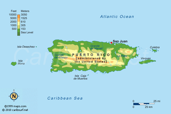
The elevation map shows the mountainous centre of the island and the lower coastal zones. Cerro de Punta, at about 1,338 m, is the highest point.
Old San Juan Satellite Map

Old San Juan occupies a compact historic peninsula at the entrance to San Juan Bay. The map is useful for understanding the relationship between the old walled city, the harbour and the modern metropolitan area.
Puerto Rico Facts & Travel Guide | Culebra Map | Vieques Map | Puerto Rico Gallery